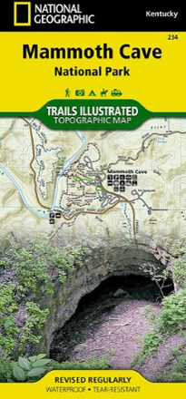


Mammoth Cave National Park Map
Tech Specs
Specifications are maintained on Pack4Back GearDB (community edits and revision history). Values may differ from the manufacturer or your unit—verify before buying.
BrandNational Geographic
Best UseHiking
State / ProvinceKentucky
Folded Dimensions9.25 x 4.25 inches
Unfolded Dimensions37.75 x 25.5 inches
Map Scale1:35,000 and 1:14,000
Double SidedYes
WaterproofYes
PublisherNational Geographic
Copyright Year2019
Map Number234
Description
Expertly researched and created with local land management agencies, this National Geographic Mammoth Cave National Park map provides detailed, accurate information to assist your exploration.
Features
- Print version includes general information about the park and cave, as well as detailed inserts of the cave area and the historic entrance and vicinity
- Shows detailed topography with contour lines, shaded relief and elevations
- Includes easy-to-read trails that are marked according to use, accurate road network, visitor centers/facilities, park regulations and contact information for local agencies
- Trail mileage between intersections will help you choose the path that's right for you
- Notates river mileage, launch sites and access points for boaters
- Clearly marks recreation features including trailheads, campgrounds, fishing areas, interpretive trails, picnic areas and rental cabins
- Other features found on this map include Mammoth Cave National Park, Nolin River and The Knobs
- Full UTM grid is printed on the map to aid with navigation
- Printed on Backcountry Tough waterproof, tear-resistant paper
- Your purchase helps support National Geographic Society nonprofit's mission of research, education, conservation and exploration