

Pacific Crest Trail Topographic Map Guide: Scodie, Piute, and Tehachapi Mountains
Tech Specs
Specifications are maintained on Pack4Back GearDB (community edits and revision history). Values may differ from the manufacturer or your unit—verify before buying.
BrandNational Geographic
Best UseBackpacking
Folded Dimensions9.25 x 4.25 x 0.1 inches
Map Scale1:75,000
Double SidedYes
WaterproofYes
PublisherNational Geographic
Copyright Year2019
State / ProvinceNevada
Map Number1010
Description
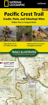
From Walker Pass to Vasquez Rocks, this Trails Illustrated Pacific Crest Trail topographic map guide covers the PCT through the southern reaches of the Sierra Nevada and into the Tehachapi Mountains.
Features
- Map guide 9 of 11 covers miles 665–450 of the Pacific Crest Trail at a scale of almost 1 inch : 1 mile
- Each page is centered on the PCT and overlaps with the adjacent pages to reduce chances of getting lost
- Along the bottom of each page is a trail profile that shows the distance between camping areas, trailheads and other points of interest
- Maps and trail profiles provide a step-by-step visual guide to hiking the trail, mile by rugged mile
- Ideal all levels of hiking enthusiasts, from day-trippers to multimonth thru-hikers
- Front pages include resupply locations, health and safety information and much more
- Printed in the USA on durable, lightweight, waterproof and tear-resistant material that's designed to withstand all weather conditions