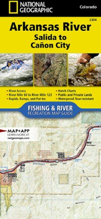


Arkansas River: Salida to Canon City Fishing and River Recreation Map Guide
Tech Specs
Specifications are maintained on Pack4Back GearDB (community edits and revision history). Values may differ from the manufacturer or your unit—verify before buying.
BrandNational Geographic
Best UseFishing
State / ProvinceColorado
Folded Dimensions9.38 x 4.25 inches
Unfolded DimensionsUnavailable
Map Scale1:31,680
Double SidedYes
WaterproofYes
PublisherNational Geographic
Copyright Year2017
Map Number2304
Description
Showing every turn and rapid, the National Geographic Arkansas River: Salida to Canon City Fishing and River recreation map guide is the ideal resource for enjoying the Arkansas River in Colorado.
Features
- From Salida to Canon City, Colorado, the Arkansas River cuts east through a series of high desert canyons collectively known as Bighorn Sheep Canyon and the Royal Gorge
- Along the way, it covers 56 river miles and drops 1,700 ft. in elevation; canyons confine the river from Salida to Howard, Coaldale to Lone Pine, and Texas Creek to Parkdale
- Between these, the terrain opens up, with the river typically becoming broader and the current velocity less
- The final stretch, the Royal Gorge, is a Class IV+ chasm that is only accessible by boat and is not known for its fishing
- National Geographic Fishing and River map guides include detailed river maps with a scale of 1 in. = 1/2 mile to clearly show every rapid and turn in the river
- Each page is centered on the river and overlaps with the adjacent pages so finding any location along the river is easy
- The maps include rapids, river miles, private and public lands, gaging stations, recreation sites, stream flow charts, hatch charts and a table of river access points
- Full UTM grid is printed on the map to aid with GPS navigation
- Printed on "Backcountry Tough" waterproof, tear-resistant paper with stainless-steel staples