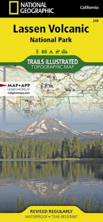

Lassen Volcanic National Park Topographic Map
Tech Specs
Specifications are maintained on Pack4Back GearDB (community edits and revision history). Values may differ from the manufacturer or your unit—verify before buying.
Description
The expertly researched Trails Illustrated Lassen Volcanic National Park topographic map is a valuable tool for exploring the park's fumaroles, hot springs, mud pots, mountain lakes and forests.
Features
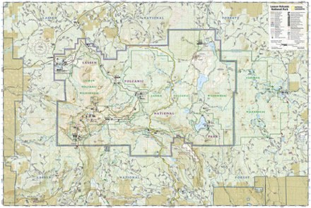
- Created in partnership with local land management agencies, this map features trails in the national park and adjacent national forests
- Includes Lassen Peak, Lassen Volcanic and Caribou wildernesses, Cinder Cone, Juniper, Snag and Butte lakes, Volcanic Legacy Scenic Byway and a detailed inset of Manzanita Lake
- Easy-to-read, detailed mapping shows comprehensive trail and road networks along with designated trails for hiking, horseback riding, biking, motorized and non-motorized use
- Clearly marked navigational aids with UTM coordinate grids, scale bar and full legend are essential for safely navigating the backcountry with a GPS or compass
- Shows key points of interest such as scenic views, campgrounds, trailheads, boat launches and picnic sites
- Color-coded boundaries for public lands, including national parks, national forests, national monuments, ranger districts, wilderness areas, state parks and wildlife refuges
- Printed in the USA on a durable, lightweight, waterproof, tear-resistant material to withstand all weather conditions
- Folded dimensions: 4.25 x 9.25 in.; unfolded dimensions: 37.75 x 25.5 in.
- 1:50,000 scale
- National Geographic Maps; copyright 2015