
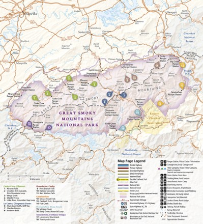
Great Smoky Mountains National Park Day Hikes Topographic Map Guide
Tech Specs
Specifications are maintained on Pack4Back GearDB (community edits and revision history). Values may differ from the manufacturer or your unit—verify before buying.
BrandNational Geographic
Best UseHiking
State / ProvinceTennessee
Folded Dimensions9.25 x 4.25 inches
Map Scale1:50,000
Double SidedYes
WaterproofYes
PublisherNational Geographic
Copyright Year2019
Map Number1702
Description
The Trails Illustrated Great Smoky Mountains National Park Day Hikes topographic map guide includes 18 diverse hikes for all outdoor enthusiasts, from the short, easy treks to strenuous loops.
Features
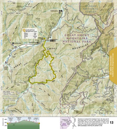
- Each hike has a detailed map, a trail profile visualizing the changes in elevation and a short summary of the interesting features you'll encounter along the trip
- Some of the must-visit sites in the guide are: Rainbow Falls, Chimney Tops and Meigs Creek Trail
- More convenient and easier to use than folded maps, but just as compact and lightweight, map guide booklets are printed on "Backcountry Tough" waterproof, tear-resistant paper
- Guide is color-coded by areas within the park
- Includes trail descriptions, difficulty ratings, trail stats, trail profiles, elevations at trail junctions and detailed directions to each trailhead
- A full UTM grid is printed on the map to aid with GPS navigation