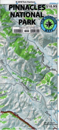
Pinnacles National Park Trail Map
Tech Specs
Specifications are maintained on Pack4Back GearDB (community edits and revision history). Values may differ from the manufacturer or your unit—verify before buying.
Best UseHiking
Folded Dimensions9 x 4.2 inches
Unfolded Dimensions26.5 x 17 inches
Map Scale1:31,680
Double SidedYes
WaterproofYes
PublisherTom Harrison Cartography
Copyright Year2018
State / ProvinceCalifornia
Description
From Tom Harrison Cartography, the Pinnacles National Park Trail Map is your guide to discovering this popular climbing, hiking and birding destination in Central California.
Features
- Easily accessed from the San Francisco Bay Area and Fresno, California, this park features volcanic formations, hiking trails, climbing crags and many birding opportunities
- Full-color shaded-relief topographic map on high-quality tear- and water-resistant paper; folds up easily and is easy to read in all conditions
- Tom Harrison maps include color-coded symbols and trails, mileage between trail junctions, UTM grids, contour lines, vegetation and elevations at trail junctions