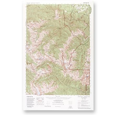

Gray Wolf - Dosewallips Map
Tech Specs
Specifications are maintained on Pack4Back GearDB (community edits and revision history). Values may differ from the manufacturer or your unit—verify before buying.
Description
Large-scale, topographic map of the Gray Wolf/Dosewallips area of Olympic National Park and Buckhorn Wilderness.
Features
- Has the same professional look and feel as a U. S. Geological Survey 15' topo map, including the standard 1:62,500 scale (1 inch to the mile)
- However, instead of the USGS "quad" format, each map is laid out to include an entire area of interest, and entire trail systems on a single map
- Trails were carefully field checked, re-mapped and depicted with easily visible red lines or dashes (depending on the maintenance class of the trail)
- Accurate distances in miles and km, true woodland shading and up-to-date roads, road numbers, names and boundaries
- Scale of 1: 62,500; contour intervals of 50 feet
- Little River Enterprises; copyright 2000