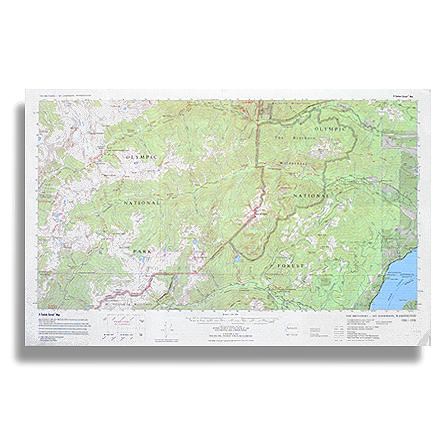

The Brothers - Mt. Anderson Map
Tech Specs
Specifications are maintained on Pack4Back GearDB (community edits and revision history). Values may differ from the manufacturer or your unit—verify before buying.
Description
Topographic trail map of The Brothers Wilderness and the adjacent part of Olympic National Park west to Mt. Anderson and O'Neil Pass
Features
- Folds out to 14.5 x 22.5 inches
- Published by Little River Enterprise; copyright 1998
- Detailed topographic map with color for easy reading; also features trail tips and safety information on the back
- Virtually every trail has been carefully field checked, measured, and re-mapped more accurately than ever before
- Accurate distances in miles and km, true woodland shading, and up-to-date roads, road numbers, names, and boundaries