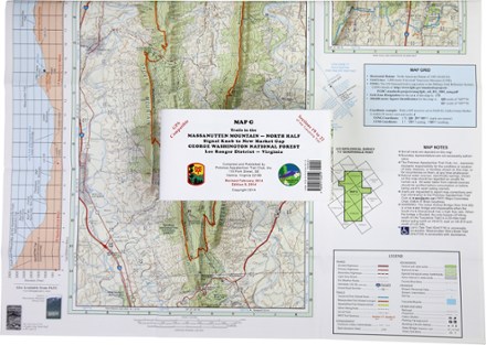
Map G - Trails in the Massanutten Mountain: Signal Knob to New Market Gap
Tech Specs
Specifications are maintained on Pack4Back GearDB (community edits and revision history). Values may differ from the manufacturer or your unit—verify before buying.
BrandPATC
Best UseHiking
State / ProvinceVirginia
Folded Dimensions6 x 4 inches
Unfolded Dimensions32 x 19.25 inches
Map Scale1:62,400
PublisherPotomac Appalachian Trail Club
Copyright Year1998, revised 2002
Description
Covering an area from Signal Knob to New Market Gap, PATC Map G details sections 19 to 22 of the Tuscarora Trail in George Washington National Forest and the 72-mile Massanutten Trail.
Features
- Area covered is from Signal Knob to New Market Gap within Lee Ranger District
- Printed on water- and tear-resistant synthetic stock in 6 colors for excellent detail and durability
- 5 km full UTM grid permits easy plotting or extraction of coordinates for use with GPS units
- Provides enlargements of the Elizabeth Furnace campground, the Camp Roosevelt Recreation Area, Woodstock Tower area and Lions Tale Trail
- Includes an elevation profile of the Tuscarora Trail from the Appalachian Trail to Fetzer Gap
- Supplies textual information on George Washington National Forest
- Scale of 1:62,400; contour intervals of 100 feet