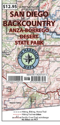
San Diego Backcountry Map: Anza-Borrego Desert State Park
Tech Specs
Specifications are maintained on Pack4Back GearDB (community edits and revision history). Values may differ from the manufacturer or your unit—verify before buying.
Best UseHiking
State / ProvinceCalifornia
Folded Dimensions7 x 3.75 inches
Unfolded Dimensions35 x 22.5 inches
Map Scale1:126720
WaterproofYes
PublisherTom Harrison Maps
Copyright Year2022
Map Number9781952473074
Description
Get to know San Diego's backyard with the Tom Harrison Cartography San Diego Backcountry map. This full color map highlights some of the best hiking and biking trails near the city.
Features
- Highlights the hiking and biking trails in the San Diego backcountry, including Anza-Borrego Desert State Park
- Includes the beginning (or end) of the Pacific Crest Trail with trail mileage
- Trails are within easy access of a major highway
- Area offers an arid climate with low altitude mountains and moderate temperatures