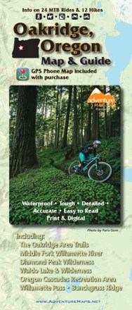
Oakridge, Oregon Map & Guide - 2020
Tech Specs
Specifications are maintained on Pack4Back GearDB (community edits and revision history). Values may differ from the manufacturer or your unit—verify before buying.
BrandAdventure Maps
Best UseMountain Biking
State / ProvinceOregon
Folded Dimensions9.75 x 4 inches
Unfolded Dimensions39 x 27 inches
Map Scale1:48,000 & 1:63,360
WaterproofYes
PublisherAdventure Maps, Inc.
Copyright Year2020
Description
The waterproof, topographic Oakridge, Oregon Adventure Map features route descriptions for MTB, hiking and equestrian trails passing through dense forest and wildflower-carpeted meadows.
Features
- Waterproof, topographic map (lat/long, UTM grids) that includes route descriptions for trails in the Oakridge area
- Located on the western slope of the Cascade Range, Oakridge and its surroundings have hundreds of miles of singletrack and forest roads for mountain bikers
- It's a region of beautiful rivers and streams, large alpine lakes and sweet, secret swimming holes just perfect for a cold dip after a hard ride
- This map covers Middle & North Fork Willamette River, Diamond Peak Wilderness, Waldo Lake & Wilderness, Oregon Cascades Recreation Area, Bunchgrass Ridge and Willamette Pass
- Includes detailed route descriptions for 24 of the best mountain bike rides in the area
- Hikers and equestrians will also find this map very useful as it accurately shows all trails with mileage points, streams, lakes, roads, and land ownership boundaries
- About 60 miles of the Pacific Crest Trail pass through this region and are represented on this map
- Diamond Peak Wilderness and Waldo Lake Wilderness are favorites with hikers and horseback riders