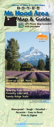
Mt. Hood Area Map & Guide
Tech Specs
Specifications are maintained on Pack4Back GearDB (community edits and revision history). Values may differ from the manufacturer or your unit—verify before buying.
BrandAdventure Maps
Best UseMountain Biking
State / ProvinceOregon
Folded Dimensions9.75 x 4 inches
Unfolded Dimensions39 x 27 inches
Map Scale1:31,680
WaterproofYes
PublisherAdventure Maps
Copyright Year2020
Description
Enjoy the old-growth trees, clear mountain streams and high-alpine views of Oregon's Mt. Hood area with this waterproof hiking map and guide from Adventure Maps.
Features
- Waterproof, topographic (latitude/longitude and UTM) trail map includes route descriptions for hundreds of miles of trails in the Mt. Hood area for a range of skill levels
- Ratings for time, mileage, aerobic and technical difficulty eliminate some of the guesswork in picking a ride or hike
- Guide features 11 mountain bike and 14 hiking descriptions, along with a blowup of the Sandy Ridge Trails
- Includes Mt. Hood, Mt. Hood Wilderness, Salmon-Huckleberry Wilderness, Badger Creek Wilderness and Roaring River Wilderness, Surveyors Ridge, Lookout Mountain and Timothy Lake
- Fishermen, equestrians, hunters and OHV riders will also find this map very useful as it accurately shows all streams, lakes, roads, OHV routes and land ownership boundaries