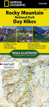


Rocky Mountain National Park Day Hikes Map
Tech Specs
Specifications are maintained on Pack4Back GearDB (community edits and revision history). Values may differ from the manufacturer or your unit—verify before buying.
BrandNational Geographic
Best UseHiking
Folded Dimensions9.25 x 4.25 x 0.3 inches
Map Scale1:50,000
Double SidedYes
WaterproofYes
PublisherNational Geographic
Copyright Year2020
State / ProvinceColorado
Map Number1701
Description
Durably made from waterproof and tear-resistant material, Trails Illustrated Rocky Mountain National Park Day Hikes map features 16 diverse hiking routes to explore in rich, topographic detail.
Features
- Each hike has a detailed map, trail profile stating the elevation changes, and a summary of the interesting features you'll encounter along the way
- UTM grid is printed on the map to make navigation easier
- Explore some of the more interesting features in the region, like Ouzel Falls and Calypso Falls in the Wild Basin and the historic prospecting site of Lulu City
- Your purchase helps support National Geographic Society's nonprofit mission of research, education, conservation and exploration