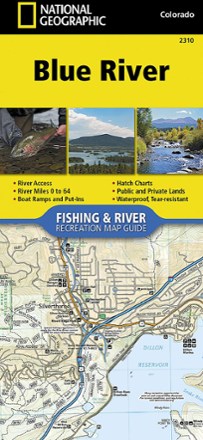


Blue River Fishing & River Recreation Map Guide
Tech Specs
Specifications are maintained on Pack4Back GearDB (community edits and revision history). Values may differ from the manufacturer or your unit—verify before buying.
BrandNational Geographic
Best UsePaddling
State / ProvinceColorado
Folded Dimensions9.25 x 4.25 inches
Map Scale1:31,680
Double SidedYes
WaterproofYes
PublisherNational Geographic
Copyright Year2018
Map Number2310
Description
The National Geographic Blue River Fishing & River recreation map guide is a compact and lightweight companion for experiencing this picturesque river and its endless recreation opportunities.
Features
- Shows rapids, river miles, access points, private and public lands, gaging stations, recreation sites and more
- Features stream flow charts, hatch charts and a table of river access points
- Each page is centered on the river and overlaps with the adjacent pages to make it easy to find any location along the river
- Includes detailed river maps at a scale of 1 in. = 0.5 miles so every turn in the river and rapid is clearly shown and labeled
- Full UTM grid is printed on the map to aid with navigation
- Printed on Backcountry Tough waterproof, tear-resistant paper with stainless-steel staples
- Your purchase helps support National Geographic Society nonprofit's mission of research, education, conservation and exploration