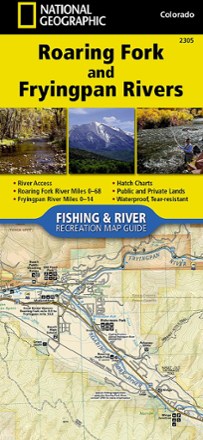


Roaring Fork and Fryingpan Rivers Fishing and River Recreation Map Guide
Tech Specs
Specifications are maintained on Pack4Back GearDB (community edits and revision history). Values may differ from the manufacturer or your unit—verify before buying.
BrandNational Geographic
Best UseFishing
State / ProvinceColorado
Folded Dimensions9.4 x 4.25 inches
Unfolded DimensionsUnavailable
Map Scale1:31,680
Double SidedYes
WaterproofYes
PublisherNational Geographic
Copyright Year2018
Map Number2305
Description
The National Geographic Roaring Fork and Fryingpan Rivers Fishing and River Recreational Map Guide is the perfect companion to anyone angling or recreating on either of these iconic Colorado rivers.
Features
- This guide covers the 68 miles of the Roaring Fork river plus the Gold Medal Waters of the Fryingpan river for 14 miles, ending at Ruedi reservoir
- National Geographic Fishing and River map guides include detailed river maps with a scale of 1 in. = 1/2 mile to clearly show every rapid and turn in the river
- Each page is centered on the river and overlaps with the adjacent pages so finding any location along the river is easy
- The maps include rapids, river miles, private and public lands, gaging stations, recreation sites, stream flow charts, hatch charts, and a table of river access points
- Printed on "Backcountry Tough" waterproof, tear-resistant paper