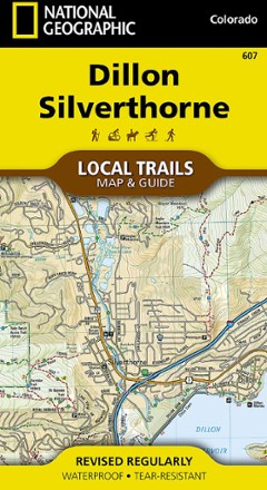


Dillon and Silverthorne Local Trails Map & Guide
Tech Specs
Specifications are maintained on Pack4Back GearDB (community edits and revision history). Values may differ from the manufacturer or your unit—verify before buying.
BrandNational Geographic
Best UseHiking
State / ProvinceColorado
Folded Dimensions7.5 x 4 inches
Unfolded Dimensions26.25 x 19.5 inches
Map Scale1:31,680
Double SidedYes
WaterproofYes
PublisherNational Geographic
Copyright Year2018
Map Number607
Description
Find breathtaking views of the Gore and Tenmile ranges with the Dillon and Silverthorne Local Trails map and guide from National Geographic. These mountain towns are just minutes from many ski areas.
Features
- Dillon and Silverthorne, Colorado, are just minutes from Breckenridge, Keystone, Copper Mountain and Arapahoe Basin ski areas
- Situated on the shores of shimmering Dillon Reservoir and crisscrossed with trails for all ability levels, it provides countless opportunities for recreation on water and land
- This map is a combination of a standard trail map on the front with a helpful guide on the back that has a selection of recommended hikes
- Recommended hikes range from the leisurely stroll on the 2.4-mile Oro Grande Trail to the incredibly steep, 3,000-foot trek up Buffalo Mountain
- Each selected trail includes a brief description, elevation gain and length, and a detailed elevation profile to track your progress up and down the numerous peaks and valleys
- Each Local Trails map includes detailed trail maps at 1 in. = 1/2 mi., showing every turn of the trail clearly plus the terrain contours
- In addition to the standard features like trailheads and parking areas, map also shows trail difficulties by segment, so you can assess the level for parts of the trail or all