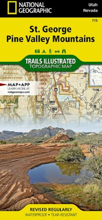


St. George Pine Valley Mountains Topographic Map
Tech Specs
Specifications are maintained on Pack4Back GearDB (community edits and revision history). Values may differ from the manufacturer or your unit—verify before buying.
BrandNational Geographic
Best UseMountain Biking
State / ProvinceUtah
Folded Dimensions9.25 x 4.25 inches
Unfolded Dimensions37.75 x 25.5 inches
Map Scale1:75,000
Double SidedYes
WaterproofYes
PublisherNational Geographic
Copyright Year2020
Map Number715
Description
No matter how you like to spend your weekend, you can use the highly detailed maps of the National Geographic St. George Pine Valley Mountains topographic map to plan your outing.
Features
- Map covers the Pine Valley Ranger District of Dixie National Forest
- Other features include Antelope Range, Beaver Dam Mountains, Bull Valley Mountains, Harmony Mountains, Lost Peak and Pine Valley Mountains
- Map also encompasses Quichapa Lake, Santa Clara River, Signal Peak and St George
- Full UTM grid is printed on the map to aid with navigation
- Printed on Backcountry Tough waterproof, tear-resistant paper