
Absaroka Beartooth Wilderness Map
Tech Specs
Specifications are maintained on Pack4Back GearDB (community edits and revision history). Values may differ from the manufacturer or your unit—verify before buying.
Description
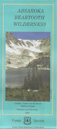
Plan an adventure with this map of the Absaroka Beartooth Wilderness, featuring a rugged, picturesque topography containing hundreds of lakes, high-rolling plateaus and deep, glacier-carved valleys.
Features
- Includes Granite Peak, Montana's highest point at 12,799 ft.
- Highlights recreation opportunities such as trails, campgrounds, boat launches and more; includes color-coded land ownership boundaries (federal, state and private)
- Includes official U.S. Forest Service district office contact information to check local conditions as well as township and range section numbers