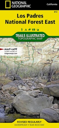


Los Padres National Forest East Trail Map
Tech Specs
Specifications are maintained on Pack4Back GearDB (community edits and revision history). Values may differ from the manufacturer or your unit—verify before buying.
Description
The National Geographic Los Padres National Forest East trail map leads you through amazing recreation opportunities in one of California's most diverse forests.
Features
- Created in partnership with the U.S. Forest Service, California State Parks and others, this detailed, expertly researched map covers Santa Barbara to Angeles National Forest
- Covers popular points of interest including Chumash, Dick Smith, Matilija and Sespe wilderness areas and Sisquoc, Sespe Creek and Piru Creek scenic rivers
- Also includes Fort Tejon and El Presidio de Santa Barbara state historic parks, Hungry Valley Recreation Area and Carpinteria State Beach
- Easy-to-read, yet highly detailed content shows comprehensive trail and road networks along with designated trails for hiking, biking, horseback riding and more
- Clearly marked navigational aids with UTM coordinate grids, scale bar and full legend are essential for navigating with GPS or compass
- Features key points of interest such as scenic views, campgrounds, trailheads, boat launches and picnic sites
- Color-coded boundaries for public lands, including national parks, national forests, national monuments, ranger districts, wilderness areas, state parks and wildlife refuges
- Printed on durable, lightweight, waterproof and tear-resistant material that is designed to withstand all weather conditions
- Folded dimensions: 4.25 x 9.25 in.; unfolded dimensions: 25.5 x 37.75 in.
- 1:80,000 scale
- National Geographic Maps; copyright 2012