

Grand Canyon National Park Trail Map - Bright Angel Canyon/North and South Rims
Tech Specs
Specifications are maintained on Pack4Back GearDB (community edits and revision history). Values may differ from the manufacturer or your unit—verify before buying.
Description
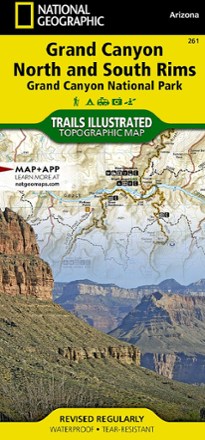
This Trails Illustrated Grand Canyon National Park trail map offers comprehensive coverage of Bright Angel Canyon and the North and South rims.
Features
- Coverage includes miles 60 - 98 of the Colorado River, North and South Rim visitor centers, Grand Canyon Village, National Geographic IMAX and Tusayan
- Also covers Grand Canyon Railroad Station, Bright Angel Trail (with elevation profile), West Rim Trail, Kaibab Trail, Arizona Trail and Grand Canyon Lodge
- Lists wilderness tips and Leave No Trace guidelines, along with trails, trailheads, points of interest, campgrounds, geologic history and much more
- Printed on waterproof, tear-resistant material with a plastic coating for exceptional durability
- Includes selected waypoints in both lat./lon. and UTM coordinate systems as well as GPS-compatible UTM grid lines for easy navigation
- Measures 9.25 x 4.25 in. folded and 39 x 27 in. fully opened; scale of 1:35,000
- National Geographic Maps; copyright 2009