
Shenandoah National Park Map
Tech Specs
Specifications are maintained on Pack4Back GearDB (community edits and revision history). Values may differ from the manufacturer or your unit—verify before buying.
Description
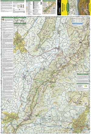
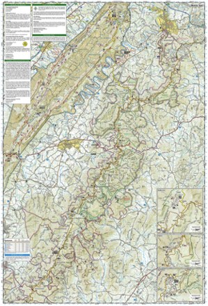
The Trails Illustrated Shenandoah National Park map offers clear, detailed coverage of the natural escape that's just 75 miles from the hustle and bustle of Washington, D.C.
Features
- Includes hiking and horse trails, the Appalachian Trail, waterfall hikes, wilderness areas and Skyline Drive
- Printed on waterproof, tear-resistant material with a plastic coating for exceptional durability
- Includes selected waypoints in both lat./lon. and UTM coordinate systems as well as GPS-compatible UTM grid lines for easy navigation
- Scale of 1:75,000 and 1:37,500
- National Geographic Maps; copyright 1991; revised 2007