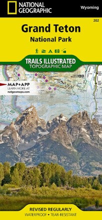


Grand Teton National Park Trail Map
Tech Specs
Specifications are maintained on Pack4Back GearDB (community edits and revision history). Values may differ from the manufacturer or your unit—verify before buying.
Description
This informative Trails Illustrated map will help you plan trips and explore the area in and around Wyoming's Grand Teton National Park.
Features
- Printed on durable, tear-resistant, waterproof material, this map can go virtually anywhere you go
- Covers multiple USGS quadrangles with the convenience of a single map
- Based on exact reproductions of USGS topo map information—updated, customized and enhanced to accurately detail the unique features of the area
- Highlights hiking trails, cross-country ski trails, bike trails, fishing holes, boat ramps, campgrounds and many other subjects of interest
- Measures 9.25 x 4.25 in. folded and 37.75 x 25.5 in. fully opened; scale of 1:80,000 and 1:31,680
- National Geographic Maps; copyright 1993 (revised 2003)