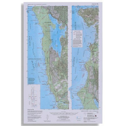

North Olympic Coast Map
Tech Specs
Specifications are maintained on Pack4Back GearDB (community edits and revision history). Values may differ from the manufacturer or your unit—verify before buying.
Description
Topographic map shows trails, beach routes and headland tides from La Push north to Cape Flattery
Features
- Folds out to 22.5 x 14.5 inches
- Little River Enterprises; copyright 1990
- All the detail of 6 USGS 7.5' quads on one sheet, plus accurate trails and beach and trail distances in miles and kilometers
- Minimum tide heights are shown for rounding headlands
- Trails, beach routes and distances are fully field checked