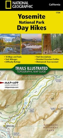


Yosemite National Park Day Hikes Map
Tech Specs
Specifications are maintained on Pack4Back GearDB (community edits and revision history). Values may differ from the manufacturer or your unit—verify before buying.
BrandNational Geographic
Best UseHiking
Folded Dimensions9.25 x 4.25 x 0.3 inches
Map Scale1:50,000
Double SidedYes
WaterproofYes
PublisherNational Geographic
Copyright Year2020
State / ProvinceCalifornia
Map Number1704
Description
Featuring 18 diverse hikes for all hiking enthusiasts, the Trails Illustrated Yosemite National Park Day Hikes topographic map guide unlocks the must-see sites in America's third national park.
Features
- Includes hikes for every skill level, from an easy 2.8 miles along Hetch Hetchy Valley Overlook to the strenuous 14.7-mile Laurel Lake Trail with 3,900 ft. of elevation gain
- Each hike has a detailed map, a trail profile visualizing the changes in elevation and a short summary of the interesting features you'll encounter along the way
- Built for all levels of hiking enthusiasts, National Geographic Topographic Map Guides are more convenient and easier to use than folded maps
- Printed on "Backcountry Tough" waterproof, tear-resistant paper with stainless-steel staples
- Your purchase helps support National Geographic Society nonprofit's mission of research, education, conservation and exploration