Filters
No categories available
No brands available
Media
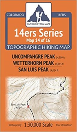
Colorado 14ers Series Map - Uncompahgre Peak, Wetterhorn Peak, San Luis Peak
Outdoor Trail MapsColorado 14ers Series Map 14 of 16 covers 14ers Uncompahgre Peak and Wetterhorn Peak on the front side and San Luis Peak on the back, including all hiking trails in the surrounding areas.

Colorado 14ers Series Map: Mount Sherman, Mount Bross, Mount Cameron, Mount Democrat, Mount Lincoln, Quandary Peak
Outdoor Trail MapsGet a strong start on your 14er bucket list with Colorado 14ers Series Map 4 of 16, which covers 6 majestic peaks in the Mosquito and Tenmile Ranges in central Colorado.
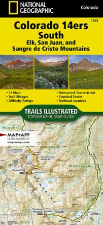
Colorado 14ers South Topographic Map Guide
National GeographicWith details for the 14ers of the Elk, San Juan and Sangre de Cristo ranges, the Trails Illustrated Colorado 14ers South topographic map guide booklet is the perfect peakbagger's companion.
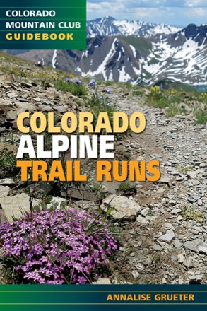
Colorado Alpine Trail Runs
Colorado Mountain ClubWhether you're seeking remote routes or reliable intel on a classic, Colorado Alpine Trail Runs is an indispensable guide to lacing up your runners and bagging peaks at top speed.
Camping and Hiking GuidebooksNorth America Hiking Guidebooks
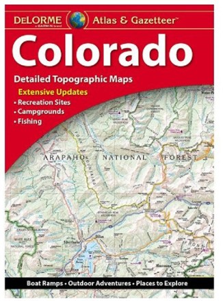
Colorado Atlas and Gazetteer
DeLormeCovering the Mile High state in fine detail, the DeLorme Colorado Atlas and Gazetteer is a travel essential for any road-trip or outdoor enthusiast.
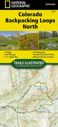
Colorado Backpacking Loops North Topographic Map Guide
National GeographicThe Trails Illustrated Colorado Backpacking Loops North topographic map guide covers a dozen loops throughout northern Colorado, selected for their diversity, remoteness and inspiring vistas.
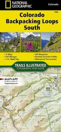
Colorado Backpacking Loops South Topographic Map Guide
National GeographicThe Trails Illustrated Colorado Backpacking Loops South topographic map guide covers a dozen loops throughout southern Colorado, selected for their diversity, remoteness and inspiring vistas.
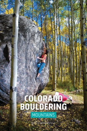
Colorado Bouldering: Mountains and Western Slope
Sharp End PublishingThe go-to guide for dedicated pebble wrestlers, Colorado Bouldering: Mountains and Western Slope provides helpful information about this national bouldering destination.
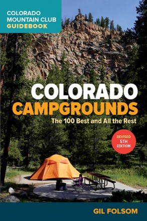
Colorado Campgrounds: The 100 Best and All the Rest - 5th Edition
Colorado Mountain ClubA great campground can make all the difference between a so-so trip and a getaway you'll treasure for a lifetime. With the 5th Edition of Colorado Campgrounds you can find your perfect spot.
Camping and Hiking GuidebooksNorth America Hiking Guidebooks

Colorado Collegiate Peaks Wilderness Map
Outdoor Trail MapsWith nine 14ers and a combined 175 miles of trails in one concentrated area, Collegiate Peaks Wilderness offers more than enough playground for adventure seekers and day hikers in central Colorado.

Colorado Comanche Peak Wilderness Map
Outdoor Trail MapsSidestep Rocky Mountain National Park's crowds and explore the cirques, streams and meadows of Colorado's Comanche Peak Wilderness. This map shows the area's hiking trails and is made for trail life.

Colorado Eagles Nest Wilderness Map
Outdoor Trail MapsColorado's 14ers come with a cost: crowds. But you can find plenty of craggy peaks, scrambles and wildlife in the Eagles Nest Wilderness. Design your own adventure with this detailed map.

Colorado Flat Tops Wilderness Map
Outdoor Trail MapsColorado's Flat Tops Wilderness spans a whopping 230,000 acres—the second largest wilderness area in the state. Explore its hundreds of miles of hiking trails with this handy topographic map.

Colorado Greenhorn Mountain/Spanish Peaks Wilderness Map
Outdoor Trail MapsExplore southern Colorado with this topographic map, covering the hiking trails in the Greenhorn Mountain Wilderness and Spanish Peaks Wilderness areas of southern Colorado.