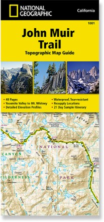
John Muir Trail Topographic Map Guide
Tech Specs
Specifications are maintained on Pack4Back GearDB (community edits and revision history). Values may differ from the manufacturer or your unit—verify before buying.
Description
Expertly researched in partnership with local agencies, the National Geographic John Muir Trail topographic map guide is an indispensable tool for navigating one of the most famous trails in the USA.
Features
- Provides elevation profiles, resupply location chart, waypoint table, wilderness safety information, history and key points of interest that you'll encounter along the trail
- Full UTM grid aids GPS navigation
- Printed on waterproof, tear-resistant paper for tough performance in the backcountry
- 1:63,360 scale
- 48 pages; color maps and images
- National Geographic Maps; copyright 2014