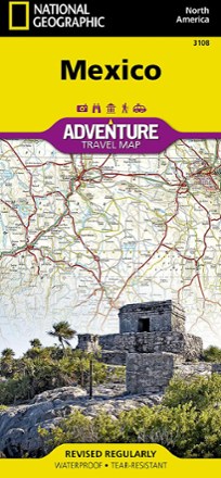
Mexico Adventure Travel Map
Tech Specs
Specifications are maintained on Pack4Back GearDB (community edits and revision history). Values may differ from the manufacturer or your unit—verify before buying.
BrandNational Geographic
Best UseTravel
Folded Dimensions9.25 x 4.25 x 0.3 inches
Unfolded Dimensions37.75 x 25.5 inches
Map Scale1:2,425,000
Double SidedYes
WaterproofYes
PublisherNational Geographic
Copyright Year2019
Map Number3108
Description
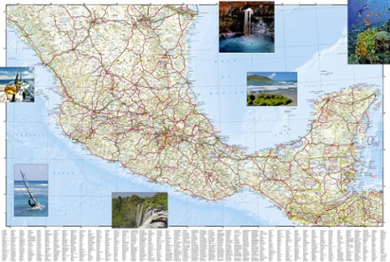
Designed with travelers in mind, the National Geographic Mexico Adventure Map is an excellent guide to Mexico's rich cultural history, national parks and archeological sites.
Features
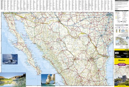
- North side of the map includes Tijuana, the Baja California peninsula, the Gulf of California and nearby parts of the U.S. including El Paso, San Antonio and Dallas
- South side shows Mexico City, Acapulco, Guadalajara, Monterrey and the neighboring countries of Belize and Guatemala as well as the western half of Honduras
- A user-friendly index of states, cities and towns will help you quickly locate your destination
- Clearly mapped road network, complete with distance markers and designations for limited access, toll and divided highways as well as secondary and other smaller roads
- Displays hundreds of cultural, ecological, historical and recreational points of interest, including many that are outside of major tourist hubs
- Points of interest include national parks, nature reserves, monuments, fortresses, archeological sites, caves and UNESCO World Heritage Sites
- Printed on durable synthetic paper, making them waterproof, tear-resistant and tough—capable of withstanding the rigors of international travel