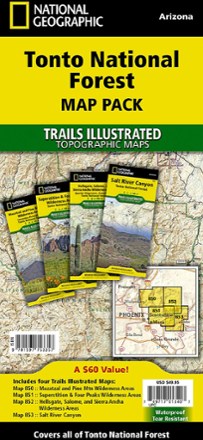

Tonto National Forest Topographic Map Pack
Tech Specs
Specifications are maintained on Pack4Back GearDB (community edits and revision history). Values may differ from the manufacturer or your unit—verify before buying.
Description
The Trails Illustrated Tonto National Forest Topographic Map Pack offers detailed coverage of almost 3 million acres of diverse terrain just outside of Phoenix, AZ.
Features
- Each map contains easy-to-read trails, numbered forest service roads, campsites, access points, scenic points of interest and important facilities
- Includes Mogollon Rim, Superstition, Mazatzal, Pine Mountain, Four Peaks, Hellgate, Salome and Sierra Ancha wilderness areas
- Also includes Salt River Canyon, Bartlett, Horseshoe, Saguaro, Canyon, Apache and Roosevelt lakes, Verde and Salt rivers, The Rolls and Bulldog Canyon
- Easy-to-read, yet highly detailed mapping shows comprehensive trail and road networks and designated trails for hiking, horseback riding, biking and more
- Clearly marked navigational aids with UTM coordinate grids, scale bar and full legend, essential for safely navigating the backcountry with GPS or compass
- Key points of interest include scenic views, campgrounds, trail heads, boat launches and picnic sites
- Color-coded boundaries for public lands including national parks, national forests, national monuments, ranger districts, wilderness areas, state parks and wildlife refuges
- Printed in the USA on durable, lightweight, waterproof and tear-resistant material designed to withstand all weather conditions
- Folded dimensions: 4.25 x 9.25 in.; unfolded dimensions: 37.75 x 25.5 in.
- 1:70,000 scale
- National Geographic Maps; copyright 2009