

Georgia Recreation Atlas
Tech Specs
Specifications are maintained on Pack4Back GearDB (community edits and revision history). Values may differ from the manufacturer or your unit—verify before buying.
Description
The durable, easy-to-use National Geographic Georgia recreation atlas is the ideal resource for your outdoor adventures in the Peach state.
Features
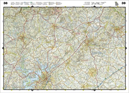
- Includes up-to-date topographic maps, a comprehensive road network, informative recreation guides and a detailed index
- Maps include bold boundaries for parks and federal lands, and clearly labeled lakes, rivers and streams
- Each map page features a convenient map legend, easy-to-read page numbers, latitude and longitude grid for use with GPS and fact-checked points of interest
- Topographic maps show road networks, points of interest, contours and shaded relief in colorful detail
- Recreation guides and maps contain campground information, state park maps and facilities, beaches, and destinations for hiking, golfing, paddling and skiing
- Hunting and fishing information includes species zones, game management units, a fishing guide, and detailed map and guide to lakes
- Color-coded boundaries for public lands including national parks, national forests, national monuments, ranger districts, wilderness areas, state parks and wildlife areas
- Dimensions: 10.75 x 15.5 in.
- 1:150,000 scale
- National Geographic Maps; copyright 2012