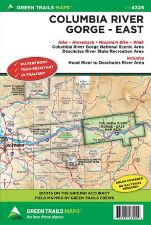
Map 432S - East Columbia River Gorge
Tech Specs
Specifications are maintained on Pack4Back GearDB (community edits and revision history). Values may differ from the manufacturer or your unit—verify before buying.
BrandGreen Trails
Best UseHiking
Folded Dimensions9 x 6 inches
Unfolded Dimensions24 x 18 inches
Map ScaleMain map 1:63,360; inset maps 1:31,680
Double SidedYes
WaterproofYes
PublisherGreat Trails Maps
Copyright Year2012
State / ProvinceWashington
Map Number432S
Description
The Green Trails East Columbia River Gorge map (432S) offers a beautifully detailed topographic guide to the scenic Gorge from Hood River to the Deschutes River National Scenic Area.
Features
- Green Trails Maps show current trail, road and access information to national forests, national parks, state and local parks, and other public lands
- Printed on waterproof and tear-resistant paper, this map stands up to the rigors of your outdoor adventure