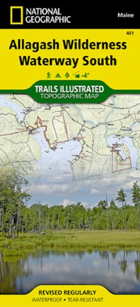


Allagash Wilderness Waterway South Map
Tech Specs
Specifications are maintained on Pack4Back GearDB (community edits and revision history). Values may differ from the manufacturer or your unit—verify before buying.
BrandNational Geographic
Best UsePaddling
State / ProvinceMaine
Folded Dimensions9.25 x 4.25 inches
Unfolded Dimensions37.75 x 25.5 inches
Map Scale1:63,360
Double SidedYes
WaterproofYes
PublisherNational Geographic
Copyright Year2019
Map Number401
Description
When paddling the Northern Forest Canoe Trail, camping in the North Maine Woods or driving the Maine Scenic Byway, the Trails Illustrated Allagash Wilderness Waterway South map is invaluable.
Features
- The map base includes contour lines, shaded relief and elevations for summits and many lakes
- Includes valuable info, such as watercraft regulations, rules for recreational use and access, river difficulty scale, checkpoints, and visitor and ranger station locations
- Boat launches, canoe carry downs, scenic viewpoints, lookout towers, points of interest, and park/forest boundaries and access points are clearly marked
- Recreation features are also clearly marked, including primitive campsites, group campsites, campgrounds, picnic areas, restrooms, parking and trailheads
- Printed on "Backcountry Tough" waterproof, tear-resistant paper