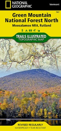


Green Mountain National Forest North Topographic Map
Tech Specs
Specifications are maintained on Pack4Back GearDB (community edits and revision history). Values may differ from the manufacturer or your unit—verify before buying.
Description
The Trails Illustrated Green Mountain National Forest North topographic map combines unmatched detail with helpful info to offer a valuable tool for making the most of your visit to this region.
Features
- Expertly researched and created in partnership with local land management agencies
- Covers Moosalamoo National Recreation Area, Branbury, Bomoseen, Ainsworth, Allis, Granville Reservation and Silver Lake state parks and Killington, Pico Mountain and Sugarbush
- Also includes Chittenden Reservoir, Bristol Cliffs, Breadloaf and Joseph Battel wilderness areas and portions of the White, Connecticut and Ottauquechee rivers
- Easy-to-read, yet highly detailed map shows comprehensive trail and road networks, along with designated trails for hiking, horseback riding, biking and more
- Clearly marked navigational aids with UTM coordinate grids, scale bar and full legend, essential for safely navigating the backcountry with GPS or compass
- Features key points of interest such as scenic views, campgrounds, trailheads, boat launches and picnic sites
- Color-coded boundaries for public lands including national parks, national forests, national monuments, ranger districts, wilderness areas, state parks and wildlife refuges
- 1:70,000 scale
- Printed in the USA on durable, lightweight, waterproof and tear-resistant material designed to withstand all weather conditions
- Folded dimensions: 4.25 x 9.25 in.; unfolded dimensions: 25.5 x 37.75 in.
- National Geographic Maps; copyright 2010