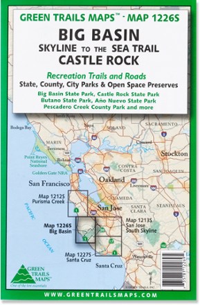
Map 1226S - Big Basin and Castlerock
Tech Specs
Specifications are maintained on Pack4Back GearDB (community edits and revision history). Values may differ from the manufacturer or your unit—verify before buying.
BrandGreen Trails
Best UseHiking
State / ProvinceCalifornia
WaterproofYes
PublisherMountaineers Books
Copyright Year2015
Map Number1226S
Description
Centered around Skyline-to-the-Sea trail, the Green Trails Big Basin and Castlerock map (1226S) offers a beautifully detailed topographic guide to this slice of the central California coastal region.
Features
- Covers Castle Rock, Big Basin State Park, Castle Rock State Park, Butano State Park, Ano Nuevo State Park and Pescadero Creek County Park
- Green Trails Maps show current trail, road and access information to national forests, national parks, state and local parks, and other public lands
- Original edition 2010; updated edition 2015