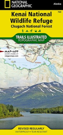


Kenai National Wildlife Refuge/Chugach National Forest Topographic Map
Tech Specs
Specifications are maintained on Pack4Back GearDB (community edits and revision history). Values may differ from the manufacturer or your unit—verify before buying.
BrandNational Geographic
Best UseHiking
State / ProvinceAlaska
Folded Dimensions9.25 x 4.25 inches
Unfolded Dimensions37.75 x 25.5 inches
Map Scale1:110,000
Double SidedYes
WaterproofYes
PublisherNational Geographic
Copyright Year2020
Map Number760
Description
This expertly researched National Geographic Kenai National Wildlife Refuge topographic map contains an abundance of information on the recreational opportunities in this expansive, biodiverse area.
Features
- Created in cooperation with U.S. Fish and Wildlife, U.S. Forest Service, National Park Service and others
- Maps hiking, equestrian, Nordic ski and ATV trails; bike paths; canoe routes and a complete road network, including numbered Forest Service roads and scenic byways
- Trails and the Swanson River canoe route are labeled according to designated usage and are shown with mileage markers
- Depicts contour lines and elevations to aid your navigation
- Labels passes, peaks, summits, water features and glaciers, as well as boating hazard areas, soundings and nautical beacons
- Pinpoints recreational sites such as campgrounds, trailheads, interpretive trails, anchorage points, boat ramps, dog mushing, wildlife viewing and scenic viewpoints
- Provides background information and regulations of the area, as well as QR codes for fishing and hunting licensing and current weather conditions
- Full UTM grid is printed on the map to aid with navigation
- Printed on Backcountry Tough waterproof, tear-resistant paper
- Your purchase helps support National Geographic Society nonprofit's mission of research, education, conservation and exploration