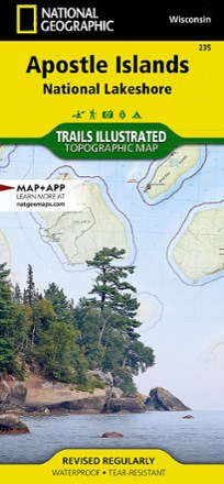


Apostle Islands Topographic Map
Tech Specs
Specifications are maintained on Pack4Back GearDB (community edits and revision history). Values may differ from the manufacturer or your unit—verify before buying.
Description
The Trails Illustrated Apostle Islands topographic map offers clear, concise info to help you savor this area's unique combination of cultural resources, natural beauty and historical significance.
Features
- Created in partnership with the National Park Service, U.S. Forest Service, Wisconsin Department of Natural Resources and Bayfield County Land Records Department
- Expertly researched map covers in unparalleled detail the 21 islands and 12 miles of Lake Superior shoreline that comprise the national lakeshore
- Also covers Red Cliffs Indian Reservation, Madeline Island, the northeastern corner of Chequamegon-Nicolet National Forest and the Bayfield Peninsula
- Easy-to-read, yet highly detailed map shows comprehensive trail and road networks, along with designated trails for hiking, horseback riding, biking and more
- Clearly marked navigational aids with UTM coordinate grids, scale bar and full legend, essential for safely navigating the backcountry with GPS or compass
- Features key points of interest such as scenic views, campgrounds, trailheads, boat launches and picnic sites
- Color-coded boundaries for public lands including national parks, national forests, national monuments, ranger districts, wilderness areas, state parks and wildlife refuges
- 1:50,000 scale
- Printed in the USA on durable, lightweight, waterproof and tear-resistant material designed to withstand all weather conditions
- Folded dimensions: 4.25 x 9.25 in.; unfolded dimensions: 25.5 x 37.75 in.
- National Geographic Maps; copyright 2007