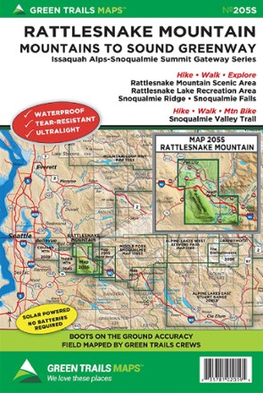
Map 205S - Rattlesnake Mountain
Tech Specs
Specifications are maintained on Pack4Back GearDB (community edits and revision history). Values may differ from the manufacturer or your unit—verify before buying.
BrandGreen Trails
Best UseHiking
Folded Dimensions9 x 6 inches
Unfolded Dimensions24 x 18 inches
Map Scale1:24,000
Double SidedYes
WaterproofYes
PublisherGreen Trails Maps
Copyright Year2017
State / ProvinceWashington
Map Number205S
Description
There are many hiking options just a short drive from Seattle. Green Trails Rattlesnake Mountain map (205S) leads from Rattlesnake Mountain to the Snoqualmie Valley in beautifully detailed topography.
Features
- Covers Rattlesnake Mountain Scenic Area, Rattlesnake Lake Recreation Area, Snoqualmie Ridge, Snoqualmie Falls and Snoqualmie Valley trails
- Green Trails Maps show the most current trail, road, and access information to national forests, national parks, state and local parks and other public lands
- Printed on waterproof and tear-resistant paper, this map withstands the rigors of adventures in less than ideal conditions