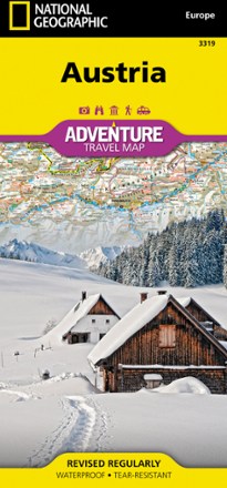

Austria Adventure Travel Map
Tech Specs
Specifications are maintained on Pack4Back GearDB (community edits and revision history). Values may differ from the manufacturer or your unit—verify before buying.
BrandNational Geographic
Best UseTravel
Folded Dimensions4.25 x 9.25 inches
Unfolded Dimensions37.75 x 25.5 inches
Map Scale1:415,000
Double SidedYes
WaterproofYes
PublisherNational Geographic
Copyright Year2022
Map Number3319
Description
A valuable tool for travelers, the National Geographic Austria Adventure travel map will help you discover and explore the many natural attractions and activities of this remarkable country.
Features
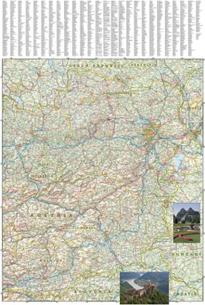
- Cities and towns are easy to find with the helpful index
- Motorways, highways, and other roads are clearly designated and include distance in kilometers so travelers can easily plan their best route
- Specialty content includes hundreds of diverse recreational, ecological, cultural and historical destinations
- World Heritage sites, wildlife parks, botanical gardens, castles, archeological sites, monuments, zoos, golf courses and museums are clearly indicated
- Western half of Austria is shown on the front side of the print map
- Western half shows borders with Liechtenstein, Switzerland, Italy and Germany and details the provinces of Vorarlberg, Tirol, Salzburg and the western half of Karnten
- Reverse side covers the eastern portion of the country
- Eastern portion shows its borders with Czech Republic, Slovakia, Hungary and Slovenia
- Eastern portion also includes the states of Steiermark, Oberosterreich, Niederosterreich, Burgenland, Wien and the eastern half of Karnten
- Printed on durable synthetic paper that is waterproof, tear-resistant and durable enough to withstand the rigors of international travel