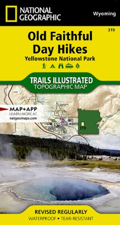


Yellowstone National Park: Old Faithful Day Hikes Topographic Map
Tech Specs
Specifications are maintained on Pack4Back GearDB (community edits and revision history). Values may differ from the manufacturer or your unit—verify before buying.
BrandNational Geographic
Best UseHiking
State / ProvinceWyoming
Folded Dimensions7.5 x 4 inches
Unfolded Dimensions37.75 x 25.5 inches
Map Scale1:30,000 & 1:15,000
Double SidedYes
WaterproofYes
PublisherNational Geographic
Copyright Year2021
Map Number319
Description
Featuring a list of recommended trails to explore, the Trails Illustrated Yellowstone National Park: Old Faithful Day Hikes topographic map details the upper and midway geyser sections of the park.
Features
- Expertly researched and created in partnership with local land management agencies
- Key points of interest include the Old Faithful geyser area, Midway Geyser Basin, Old Faithful and Fountain Paint Pots
- A list of recommend day hikes includes distances and difficulties
- Precisely mapped trails with mileage markers and and marked Bear Management Zones let you get off the beaten path; includes a portion of the Continental Divide Trail
- To aid navigation, the map includes contour lines, elevations, summits, passes and many lakes
- Marked recreation features include visitor centers, campgrounds, trailheads, hydrothermal features and interpretive trails
- Every Trails Illustrated map is printed on "Backcountry Tough" waterproof, tear-resistant paper