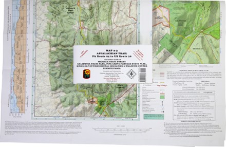
Appalachian Trail Map: PA Route 94 to US Route 30 and Other Trails
Tech Specs
Specifications are maintained on Pack4Back GearDB (community edits and revision history). Values may differ from the manufacturer or your unit—verify before buying.
BrandPATC
Best UseHiking
State / ProvincePennsylvania
Folded Dimensions8.5 x 4 x 0.125 inches
Unfolded Dimensions32 x 25 inches
Map Scale1:50,000
Double SidedYes
PublisherPotomac Appalachian Trail Club
Copyright Year2013
Map Number2-3
Description
Ready to explore Pennsylvania? The PATC Appalachian Trail Map 2–3 of PA Route 94 to US Route 30 covers sections 12 and 13 of the state's Appalachian Trail in full color.
Features
- Features elevation profiles, gates and barriers; shows where you'll encounter streams, springs, falls and views
- Includes information on shelters, campgrounds, cabins and hostels, plus parking areas
- Covers AT Corridor, state parks, forests and game lands
- Includes details on trails in Michaux State Forest, Caledonia State Park, Pine Grove Furnace State Park, Kings Gap Environmental Education & Training Center
- GPS compatible