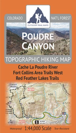
Poudre Canyon Topographic Map
Tech Specs
Specifications are maintained on Pack4Back GearDB (community edits and revision history). Values may differ from the manufacturer or your unit—verify before buying.
BrandOutdoor Trail Maps
Best UseHiking
State / ProvinceColorado
Folded Dimensions7 x 4 x 0.25 inches
Unfolded Dimensions27 x 19 inches
Map Scale1:44,000
Double SidedYes
WaterproofYes
PublisherOutdoor Trail Maps
Copyright Year2020
Description
Plan your own adventure with the light, tough and compact Poudre Canyon topographic map. It shows all of the hiking trails in and around the Cache La Poudre River canyon and Red Feather Lakes areas.
Features
- Map covers the hiking trails along the entire Poudre Canyon Highway from Fort Collins, Colorado, west to just before Cameron Pass
- Includes the Red Feather Lakes area, Mount Margaret area and Cache La Poudre Wilderness
- Folds down to 7 x 4 in. to fit easily in your pocket while hiking; unfolded, the map measures 27 in. x 19 in., making it easy to handle even in the mountain winds
- Weighs under 2 oz. to help keep your pack weight at a minimum
- Convenient 1:44,000 scale is intuitive and easy to use on the trail
- 50 ft. contours are labelled every 250 ft. and include topographic hillshading
- Mileage provided for all trail segments so you can get an accurate estimate of miles travelled or miles to go
- Includes latitude-longitude coordinates for key trailheads and trail junctions for use in conjunction with GPS devices
- UTM grid as well as latitude-longitude marks allow finding your location in either system
- Printed on waterproof and tear-resistant material