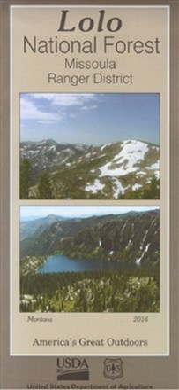


Lolo National Forest - Missoula Ranger District Map
Tech Specs
Specifications are maintained on Pack4Back GearDB (community edits and revision history). Values may differ from the manufacturer or your unit—verify before buying.
Description
Discover 40,000 acres of public lands ready for hiking, mountain biking, horseback riding and more in the Missoula Ranger District. Plan your outdoor adventure with this map of Lolo National Forest.
Features
- Includes 40,000 acres of land with opportunities to hike, mountain bike, ride horses, picnic and cross-country ski; 30 miles east of Missoula is the Rock Creek Recreation Area
- Printed on waterproof and tear-resistant material for durability
- Highlights recreation opportunities such as trails, campgrounds, boat launches and more; includes color-coded land ownership boundaries (federal, state and private)
- Includes official U.S. Forest Service district office contact information to check local conditions as well as township and range section numbers