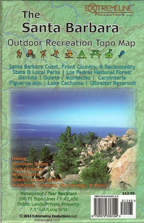
Santa Barbara Outdoor Recreation Topo Map
Tech Specs
Specifications are maintained on Pack4Back GearDB (community edits and revision history). Values may differ from the manufacturer or your unit—verify before buying.
Description
Designed with hikers, mountain biker, climbers and surfers in mind, Santa Barbara Outdoor Recreation Topo Map indicates areas of interest on the coast, in the front country and in the backcountry.
Features
- Map includes information on hiking, mountain biking, rock climbing, wind sports, beaches, surf breaks, trailheads, camping hot springs and more
- Area of coverage includes state and local parks, Los Padres National Forest, Gaviota, Goleta, Montecito, Carpinteria, Figueroa Mountain, Lake Cachuma and Gibraltar Reservoir
- Printed on both sides of waterproof and tear-resistant material