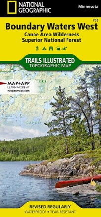


National Geographic 753 Boundary Waters - West and Superior National Forest Trail Map
Tech Specs
Specifications are maintained on Pack4Back GearDB (community edits and revision history). Values may differ from the manufacturer or your unit—verify before buying.
Description
This Trails Illustrated 753 Boundary Waters - West and Superior National Forest trail map from National Geographic offers detailed coverage of the western Boundary Waters Canoe Area Wilderness.
Features
- Covers Ash River, Crane Lake, Kabetogama and Rainy Lake visitor centers, Gull Island Rookery, Grassy Bay Cliffs, Anderson Bay, Kettle Falls, Hoist Bay, and Gold Portage
- Lists wilderness tips and Leave No Trace guidelines, along with trails, trailheads, points of interest, campgrounds, geologic history and much more
- Printed on waterproof, tear-resistant material with a plastic coating for exceptional durability
- Includes selected waypoints in both lat./lon. and UTM coordinate systems as well as GPS-compatible UTM grid lines for easy navigation; scale of 1:70,000
- National Geographic Maps; copyright 2010