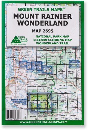
Map 269S - Mount Rainier Wonderland
Tech Specs
Specifications are maintained on Pack4Back GearDB (community edits and revision history). Values may differ from the manufacturer or your unit—verify before buying.
BrandGreen Trails
Best UseHiking
State / ProvinceWashington
Unfolded Dimensions30 x 22.5 inches
Map Scale1:63,360 (main map); back: 1:24,000 (climbing routes)
Double SidedYes
WaterproofYes
PublisherGreen Trails Maps
Copyright Year2010
Map Number269S
Description
The Green Trails Mount Rainier Wonderland map offers a beautifully detailed topographic guide to Mount Rainier National Park and the famous Wonderland Trail.
Features
- Printed on waterproof and tear-resistant paper, this map stands up to the rigors of your outdoor adventure
- One side features the entire national park at a scale of 1:63,360; the other side shows a 1:24,000 climbing map with the most popular routes to the summit
- Map includes a Wonderland Trail elevation profile, GPS waypoints and climbing route details