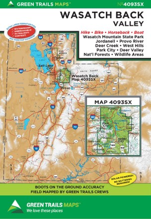
Map 4093SX - Wasatch Back, UT
Tech Specs
Specifications are maintained on Pack4Back GearDB (community edits and revision history). Values may differ from the manufacturer or your unit—verify before buying.
BrandGreen Trails
Best UseHiking
State / ProvinceUtah
Folded Dimensions6 x 9 inches
Unfolded Dimensions30 x 22.5 inches
Map Scale1:35,250
Double SidedYes
WaterproofYes
PublisherGreen Trails Maps
Copyright Year2020
Description
Stretching from to Wanship to Sundance, the Green Trails Wasatch Back map (4093SX) offers a beautifully detailed topographic guide to this region in Utah.
Features
- Covers Wasatch Mountain State Park, Jordanell, Provo River, Deer Creek, West Hills, Park City and Deer Valley National Forest
- Green Trails Maps show current trail, road and access information to national forests, national parks, state and local parks, and other public lands
- Printed on waterproof and tear-resistant paper with a 60% larger format, this map withstands the rigors of adventures in less than ideal conditions