
GPSMAP 65s
Tech Specs
Specifications are maintained on Pack4Back GearDB (community edits and revision history). Values may differ from the manufacturer or your unit—verify before buying.
BrandGarmin
Best UseNavigating
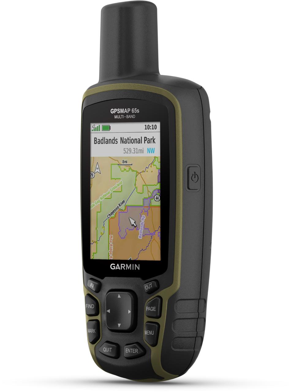
Preloaded MapTopo
BasemapYes
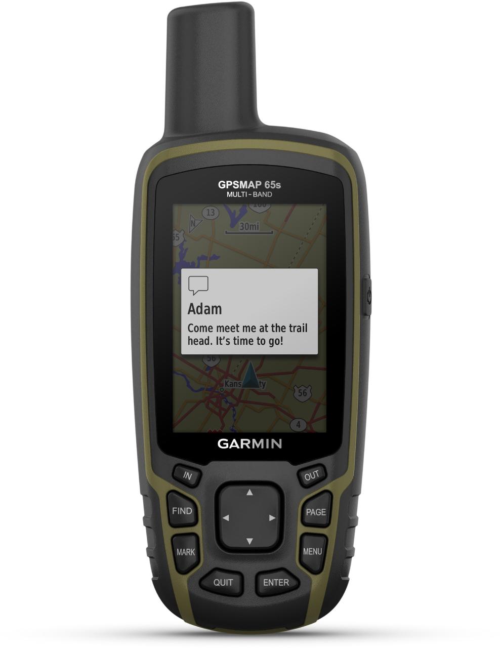
Wireless CommunicationYes
OS CompatibilityWindows / Mac
Display Size2.6 inches
Screen Pixels160 x 240
Visual Map DisplayYes
Color ScreenYes
Number of Routes200
Number of Waypoints5000
Internal Memory16 gigabytes
Expandable MemoryYes
CompassYes
AltimeterPressure-based
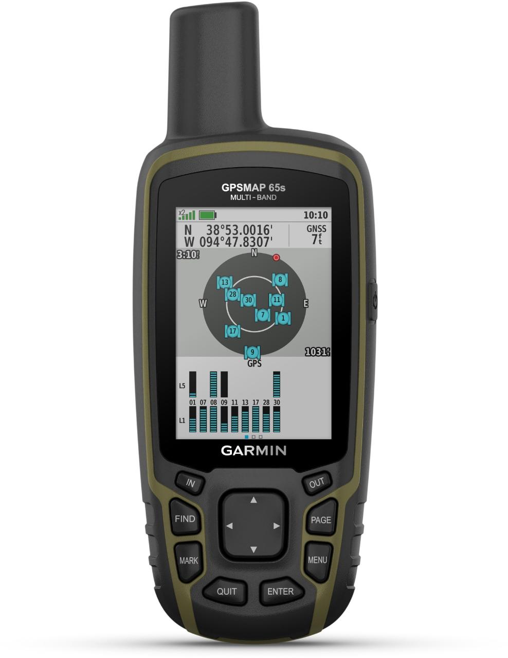
Quad Helix AntennaYes
Compact AntennaYes
Position Accuracy3 meters
Battery TypeNiMH
Batteries2 AA
Average Battery Life16 hours
Dimensions6.3 x 2.4 x 1.4 inches
Water-Resistance RatingIPX7
Weight7.8 ounces
Description
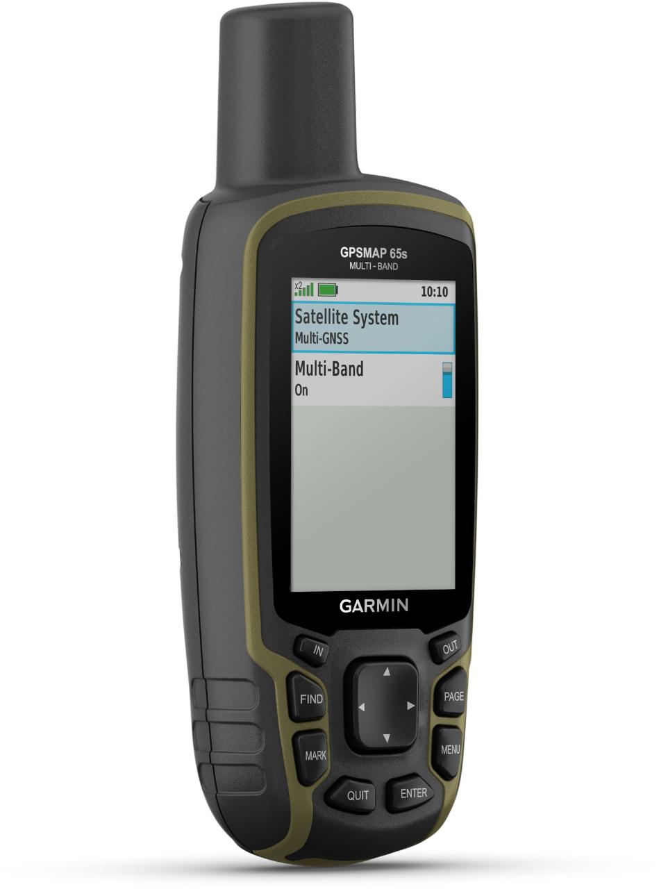
Find your way through steep country, urban canyons and densely treed forests with the Garmin GPSMAP 65s, a rugged handheld with multi-band technology and expanded GNSS support.
Features
- Expanded global navigation satellite systems (GNSS) and multi-band technology help to track your route in challenging environments that would prove difficult for GPS alone
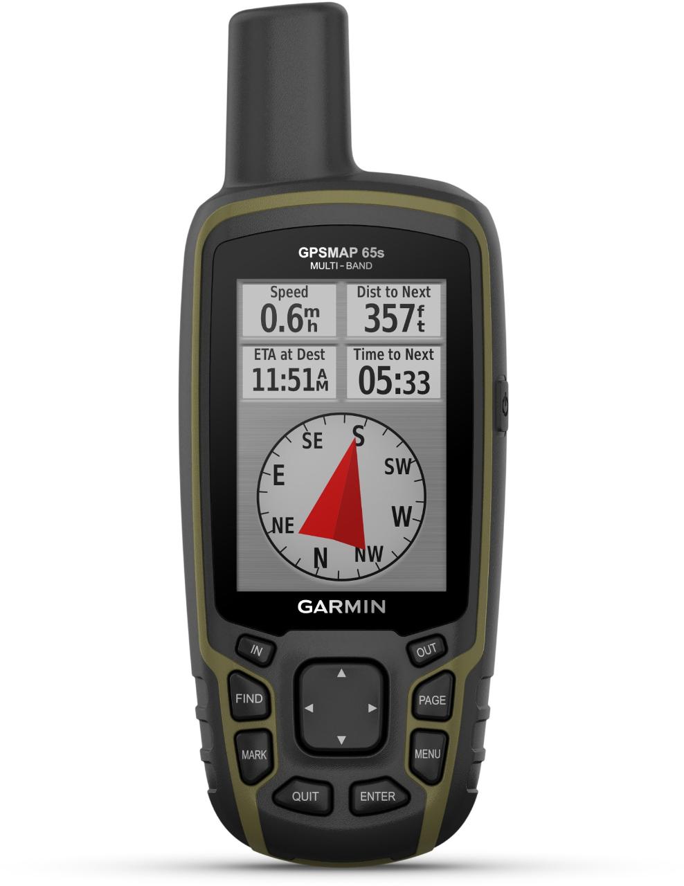
- Navigate every trail with ABC sensors, including an altimeter for elevation data, barometer to monitor weather and 3-axis electronic compass
- Large, sunlight-readable display measures 2.6 in. with 160 x 240 pixels to present imagery in crisp and colorful detail
- Connectivity via Bluetooth and ANT+ lets you share your waypoints, tracks, routes and geocaches wirelessly with other compatible devices
- Compatible with Garmin Explore™ website and app to help you manage tracks, routes and waypoints and review statistics from the field
- Includes routable TopoActive mapping and federal public land map
- IPX7 rating means this is considered waterproof; it can withstand submersion in water up to 1 m deep for up to 30 min.