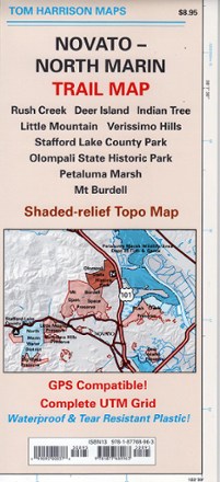
Novato-North Marin Trail Map
Tech Specs
Характеристики ведутся в Pack4Back GearDB (сообщество и история правок). Возможны расхождения с производителем или вашим экземпляром.
Best UseHiking
Folded Dimensions22.9 × 10.2 × 0.3 cm
Unfolded Dimensions61.0 × 45.7 cm
Map Scale1:24,000
Double SidedYes
WaterproofYes
PublisherTom Harrison Cartography
Copyright Year2007
State / ProvinceCalifornia
Description
Discover hiking, running and mountain biking trails in the Tom Harrison Cartography Novato–North Marin trail map, and explore all this rolling, oak-studded region has to offer.
Features
- Map covers Rush Creek, Deer Island, Indian Tree, Little Mountain, Verissimo Hills, Stafford Lake County Park, Olompali State Historic Park, Petaluma Marsh and Mount Burdell
- Full-color shaded-relief topographic map on high-quality tear- and water-resistant paper; folds up easily and is easy to read in all conditions
- Tom Harrison maps include color-coded symbols and trails, mileage between trail junctions, UTM grids, contour lines, vegetation and elevations at trail junctions