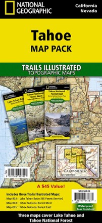

Tahoe Map Pack
Tech Specs
Характеристики ведутся в Pack4Back GearDB (сообщество и история правок). Возможны расхождения с производителем или вашим экземпляром.
BrandNational Geographic
Best UseMultisport
State / ProvinceCalifornia
Folded Dimensions23.5 × 10.8 cm
Unfolded Dimensions95.9 × 64.8 cm
Map Scale1:63,360
Double SidedYes
WaterproofYes
PublisherNational Geographic
Copyright Year2019
Map Number803
Description
The sapphire jewel in the crown of the Sierra Nevada, Lake Tahoe, and the surrounding area, offers lots to explore. Plan your adventure with this Trails Illustrated Tahoe map pack.
Ключевые факты
- Map pack includes map 803: Lake Tahoe Basin, map 804: Tahoe National Forest West and map 805: Tahoe National Forest East
- Many recreation features are noted, including ski areas, campgrounds, trailheads, wildlife viewing areas, boat launches, scuba diving areas, swimming areas and fishing areas
- Maps feature contour lines and elevations, labeled peaks and passes and hundreds of water features
- Every Trails Illustrated map is printed on "Backcountry Tough" waterproof, tear-resistant paper
- A full UTM grid is printed on the map to aid with digital navigation