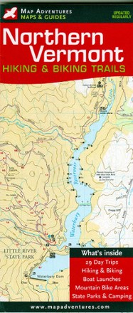
Northern Vermont Hiking & Biking Trails Map
Tech Specs
Specifications are maintained on Pack4Back GearDB (community edits and revision history). Values may differ from the manufacturer or your unit—verify before buying.
BrandMap Adventures
Best UseHiking
State / ProvinceVermont
Folded Dimensions8.8 x 4 inches
Unfolded Dimensions24 x 27 inches
Map Scale1:40,000
Double SidedYes
WaterproofYes
PublisherMap Adventures
Copyright Year2019
Description
Discover some of the best hikes and MTB rides along mountain summits, pristine lakes, hidden footpaths and open fields with the Map Adventures Northern Vermont hiking & biking trails map.
Features
- Easy-to-use map with researched trail information, including trail descriptions, camping, shelters, mileage points and points of interest
- Includes 29 suggested day trips, mountain biking areas and trails, as well as boat and kayak put-ins
- Areas covered: Mount Mansfield and Stowe Area Trails, Camel's Hump, Lake Willoughby, Little River and Smugglers' Notch State Park, and Belvidere Mountain
- Also features sections of both the Long Trail and the Catamount Trail