Ausable River Fly Fishing Map
Tech Specs
Specifications are maintained on Pack4Back GearDB (community edits and revision history). Values may differ from the manufacturer or your unit—verify before buying.
BrandGreen Goat Maps
Best UseFishing
State / ProvinceNew York
Folded Dimensions6 x 4 x 0.25 inches
Unfolded Dimensions24 x 12 inches
Map Scale1:40,000
Double SidedYes
WaterproofYes
PublisherGreen Goat Maps
Copyright Year2019
Description
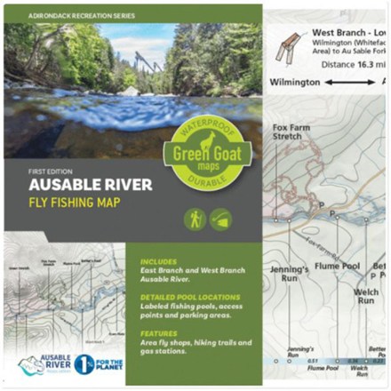
Detailing the east and west branches of the Ausable River in New York's Adirondack Park, Green Goat Maps Ausable River Fly Fishing map was made for anglers, paddlers and river enthusiasts of all kind.
Features
- Shows river current, access paths, parking areas, NYS fishing regulations, a hatch chart, local fly shops and more
- Includes labeled fishing pools and nearby hiking trails with trail information, access points and parking areas
- Green Goat Maps worked with the Ausable River Association to highlight the importance of river health and native brook trout in this environmentally focused map
- Durable and tear-resistant map printed on waterproof HopSyn material
- Green Goat Maps gives 1% back to nonprofits through 1% for the Planet